


Disrupting the disrupter — that was the goal when designing the new Leica BLK360 laser scanner. And while we could go on about the improvements made to this latest iteration — faster scanning times, smaller size, inclusion of Leica Geosystems’ Visual Inertial System (VIS) — we thought it would be better to share some initial reactions from users themselves. (Some posts edited for clarity).
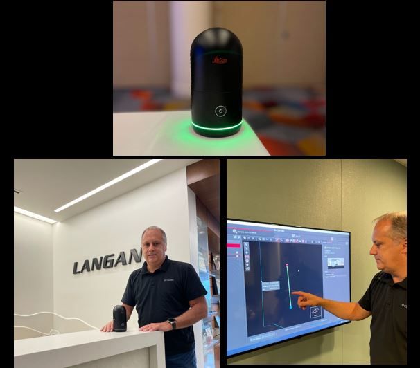
I got to use the NEW BLK360. It is smaller, lighter and delivers the high-quality point cloud data that Leica Geosystems is known for. The imagery from the new unit is outstanding and provides for a clear interface to the data. One of the best parts is the NEW BLK360 fits into our current workflow. Hat’s off the development team.
Joseph Romano
Principal, Surveying & Mapping at Langan Engineering and Environmental Services
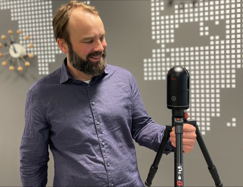
Wieso got to test the new BLK 360 last week (pre-release). We are very happy with our BLK360 1. gen, but this new one… Man, it scans really quick and has four densities. On the app you can follow the scanner’s movement, just like on the RTC360, and I love that you can remove noise from scans as you go. But for us, the coolest part is that the. e57-files can be exported directly via the unit’s USB-C-port.🤘
Petter von Krogh
COO at Wieso AS
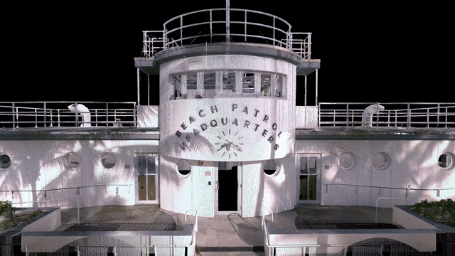
We laser scanned the historic Miami Beach Patrol Headquarters with Leica Geosytems’ new BLK360 scanner. It took just 15 minutes to capture 23 scans (plus time to move our tripod between scans).
Each medium density 3D scan now takes just 37 seconds, which really helps with public spaces. With the previous BLK360, the same scan would take almost three minutes.
Architect Robert A. Taylor designed this “Streamline Moderne” architectural gem in 1934. Today, the structure is constantly surrounded by moving city vehicles, tourists, beachgoers and the Ocean Rescue team. In the commotion, we quickly scanned all façades and multiple roof levels, capturing 360° colour photos at the same time.
Once processed in Cyclone Register360, our point cloud provided an accurate basis for four 2D AutoCAD elevations and a roof plan. (We did not scan the interior.)
Special thanks to Leica Geosystems for letting us have some fun with this great new piece of equipment!
Corey Weiner
As-Built Laser Scan Measurement Service
Maybe not a perfect wizard, but isn’t this magic?
The new BLK360 is simply amazing!
Smaller, faster and lighter!
Carlo Giannattasio
Product Engineer and Ph.D. in Civil Systems Engineering
This little devil is pretty impressive. Got my hands on one early. A few of the highlights:
- 20 second scan + image
- Automatic on-site registration with VIS
- 5 bracket HDR imaging
- 4mm 3D accuracy
- Less than 2 pounds
- Small enough to perch on my shoulder!
This should bring high-quality laser scanning within reach for a lot of Public Safety and Forensic professionals.
William Henningsen
Forensic Manager – Forensic Video Analyst – HDS Laser Scanning
Gamechanger! Smaller, faster, more accurate and with HDR. I’m truly grateful and honoured to be one of the first unboxing this new scanner. Thank you #leica Sweden, I can’t wait to take this into field.
Mikael Karlsson
Measurement consultant at MKK i Sverige AB
“Infinite cosmic powers in a tiny living space.”
The BLK360 surpasses itself in speed, lightness, size and photo quality.
Only the VIS is missing… Oops! They put that too!
Arch. Alessandro Grieco
Architect expert in laser scanner surveys
New and improved- a popular catch phrase in advertising and marketing. In the case of the new BLK360 it is actually an understatement. Faster, smaller, lighter with the addition of VIS technology. What does all that mean? How about 360 scans in 20 seconds? Utilizing VIS technology, you’ll have self-registering scans like one of the bigger scanners. A much-improved accuracy. New and improved indeed!
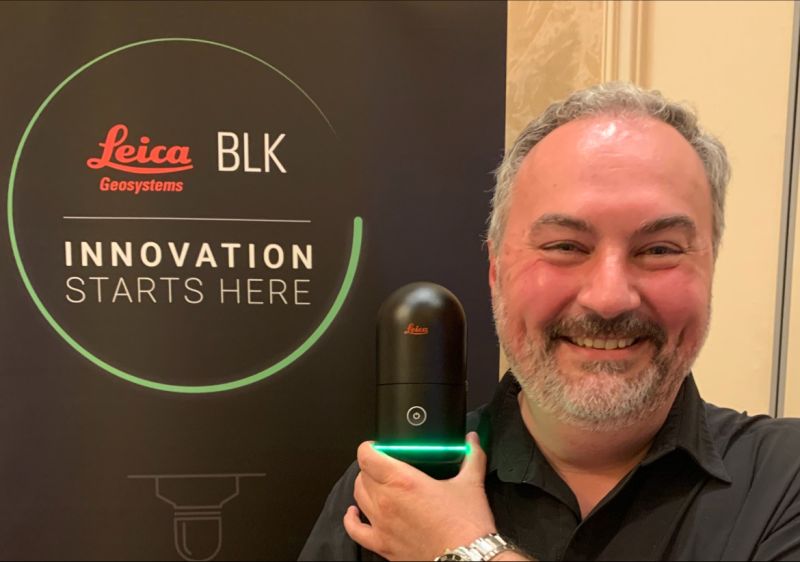
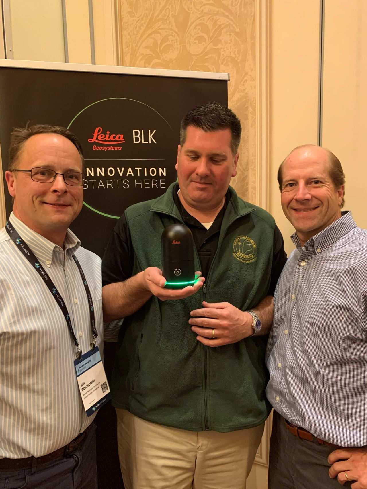
MAINE TECHNICAL SOURCE
Innovative tool… another big step forward in static laser scanner technology!!
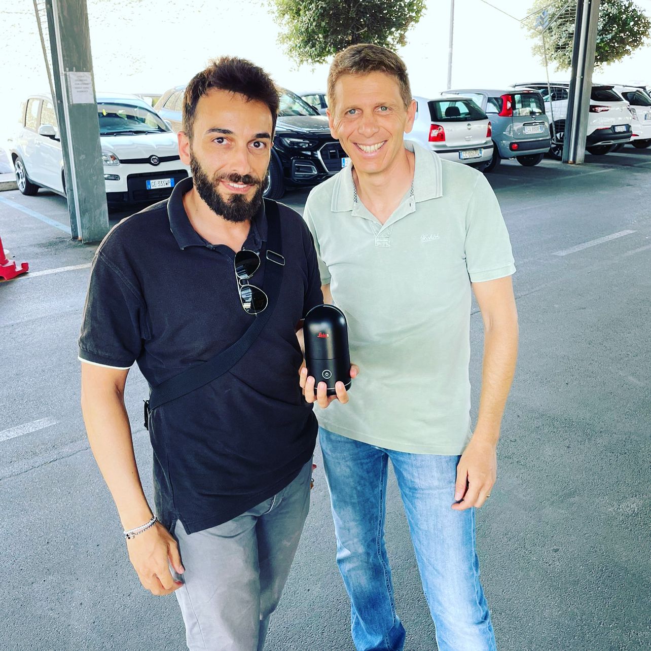
Grateful to Leica for being the first to be able to preview the NEW LEICA BLK360 first hand!
Dario Angelini
Technical engineer specialized in 3D laser scanner and topographic surveys at Angelini Geom. Adriano Srl
VIS on the new BLK360 Gen2? It really *IS* a big deal!!
With the launch of the next generation of BLK360, many people were surprised by the massive step forwards made in the entry level scanner segment.
Full 360-degree scans in less than 20 seconds all the way up to high density scans with 5 bracket HDR in just 1 minute and 37 seconds — TOTAL.
But the headline for many — myself included — was the addition of VIS, or the Visual Inertial System to the device and the huge significance of this to the onsite workflow.
Now, for many Leica Geosystems laser scanner users, this will be familiar ground as they will be aware of, and no doubt love, the functionality of VIS having experienced it on the RTC360.
But to many, VIS is an entirely new concept, and the benefits will be relatively unknown. Additionally, the BLK360 Gen2 will continue to bring people into the practice of laser scanning as total “newbies,” such has its appeal always been whether in Gen1 or Gen2 guise, and so the need to have an understanding of VIS on this device is important.
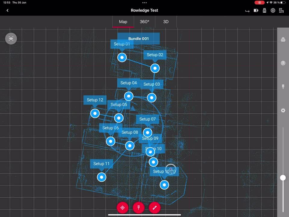
VIS allows for the automated pre-alignment of scans to occur— in the field, on the device itself. The movement of the device, from one set up to the next, is tracked by the onboard cameras and the relative movements and rotations of the device is calculated so that the successive set up position and orientation is known relative to the last. This, in turn of course, means that the acquired scan data from the secondary set up position is also known in terms of relative alignment and location information. The result is super-fast automated pre-registration in the field.
For many users, this is visualised by using the Field 360 app on a smart device…in my personal case I use my iPad Pro with LiDAR so that I can take full advantage of the beta version of Field360 I have been using for a little while now, and I can add LiDAR acquired data from the Apple device into my project! (More of this to come…)
VIS on the BLK360 is, in my opinion, a huge step forwards at this level and remains a globally unique advantage of the Leica Geosystems RTC360 and BLK360 scanners, well suited to public safety users.
Here, a video with VIS active and showing my BLK360 moving through the ground floor survey of this crime house — follow the sonar style pulse.
Marcus Rowe L.C.G.I
Business Manager – Public Safety at Leica Geosystems part of Hexagon
Keep up with what your colleagues are saying about the new BLK360 by following the hashtag #blk360realitycapturenow or explore more laser scanning content on the Leica Geosystems BLK blog.


