


Hexagon’s global solutions are putting data to work to achieve productivity, sustainability and efficiency goals. But how is data actually put to work? In this Q&A, we sat down with David MacDonald, support technical lead of Waypoint software at Hexagon’s Autonomy & Positioning division, to discuss how Waypoint software’s post-processing leverages positioning and navigational data to support users’ goals.
Waypoint software allows users to input their global navigation satellite systems (GNSS) and inertial measurement unit (IMU) and other supplemental data from survey or mobile mapping applications. The raw data requires post-processing to output the most accurate results.
David has been working with Waypoint software for twenty years. He has taught many training sessions for users to make the most out of their software. The next training session occurs during the Autonomy & Positioning Innovation Summit at HxGN LIVE Global, where attendees can get hands-on experience and face time with David to guide their post-processing. Training registration is by invitation only – contact us if you’d like to learn more.
Thanks for sitting down with us! From your twenty years of experience, what do people use Waypoint software for?
Well, Waypoint software, specifically the Inertial Explorer tool, generates high-rate post-processed trajectory data. It inputs GNSS and inertial data and then outputs an accurate ground truth reference that is used to test algorithms or less accurate inertial or positioning systems. The ground truth reference may also be used in downstream processes to generate a point-cloud map.
Are there specific applications that need to use this data in their work?
Inertial Explorer is used across applications, but most commonly in aerial survey and mobile mapping since both applications require high-rate and accurate trajectory data.
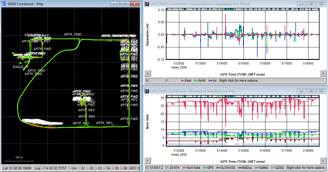
An example of what a post-processed trajectory looks like within Waypoint software.
A ground truth trajectory means that you know that route to be as accurate to the vehicle’s actual position or other systems as possible. That’s why it’s used in testing and comparing other sensors’ data outputs.
Can it be used to enable autonomous applications?
Safe autonomous applications, whether operating on an urban road, a field or a mining facility, can’t be developed without thorough testing of their systems and sensors – and you need an accurate ground truth reference to accomplish that. The high-precision maps made from Waypoint’s generated data are vital in developing anything autonomous.
You’ve trained countless individuals in Waypoint software and the next opportunity is in June during HxGN LIVE Global. What do you hope attendees will get from this year’s training?
Waypoint software and Inertial Explorer outputs are only as good as your quality control when processing the raw data. This training helps attendees gain confidence with Inertial Explorer and interpret data effectively. They’ll learn how to identify potential biases in the output and which re-processing techniques to use to resolve those biases. The software puts the user’s data to work for them, so the training will teach attendees different processing techniques and modes and how to balance processing loads with processing efficiency.

This year, I’m offering to use attendees’ data in demonstrations and examples instead of my own sample surveys. We’ll work through potential biases based on your specific application or environment and learn how to interpret the output accurately together. This is a new feature of the training and I’m excited to see what kinds of data attendees provide.
—
To learn more about Waypoint software and the training session during the Autonomy & Positioning Innovation Summit, contact us by email.


