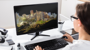
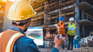
Introducing the Leica Pegasus: Backpack for measurement professionals on the go. This podcast examines the need for mobile and wearable mapping in today’s surveying landscape including the BIM, 6D and SLAM technology.
Welcome to HxGN Radio. This is your host Monica Miller-Rodgers. Thank you for joining us for today’s podcast episode titled “Going Mobile and Wearable with Reality Capture” brought to you by Hexagon Geosystems. In today’s podcast we are talking to Alessandro Nuzzo product line manager for mobile mapping at Leica Geosystems.
MM: Thank you Alessandro for joining us today.
AN: Hi. It’s a pleasure to be here.
MM: Leica Geosystems released the industry’s first wearable reality capture platform, the Leica Pegasus Backpack, earlier this year combining 5 high dynamic cameras which work in a variety of light conditions and LiDAR profiler, with an ultralight carbon fiber chassis. This solution created a 3D view indoors or outdoors for engineering or professional documentation creation. Alessandro, what need did you see in the industry for such a solution as this?
AN: So the industry is asking for a position diagnostic solution to mitigate the setup time for progressive scanning. This means everywhere you have to document indoor and outdoor environment changes in a fast and periodical that Leica Pegasus Backpack would be the right answer. Leica Pegasus Backpack is a tough breaking wearable alternative professional documentation solution that adds to the classic concept of accuracy.
MM: Can you explain, Alessandro, how this new solution works?
AN: As the name Pegasus Backpack suggests it is a wearable backpack solution integrating GNSS, photogrammetry, LiDAR and SLAM technology for the inter-positioning. So after 5 minutes in its alteration, the system is ready to collect over the 5 cameras videos and over to 2 LiDAR 3D point clouds we felt the limit of GNSS out gage, just collect everywhere.
MM: So when you say everywhere, that’s a lot of applications. Can you give us a few examples of where this can be used?
AN: Yes, sure. The Pegasus Backpack is a powerful alternative professional documentation tool. A typical application is BIM documentation where you have to monitor milestones or visual validation for payment approval. Another application is professional training. Imagine our nuclear power station, a technician must be trained for an emergency on a realistic simulator. An environment where reality closed training will make the difference. Another application, so basically, unlikely natural disasters are accumulating. A fast situation analysis after natural disaster helps planning rescue and immediate action for city protection. It helps also for the construction process where real data helps budgeting realistic barriers.
MM: So the Leica Pegasus Backpack works in GNSS denied areas using a new technology which is called the simultaneous localization and mapping or SLAM for short. Can you explain what this new technology actually does and what it is, Alessandro?
AN: Sure. SLAM is an orientation technology from Robotic, where autonomous robots need to orient themselves without GNSS. We applied this technology using LiDAR not only to provide 3D point clouds for measurements but are using it to calculate the position. Imagine you’re entering a new building which you have never seen before. Your brain will automatically start to detect a point of reference that will help you to recognize your position and space. Basically SLAM works with the same principal.
MM: So Alessandro you just mentioned new building in of course it’s very popular in the industry right now is building information modeling or BIM for short. So what benefits does the Leica Pegasus Backpack bring to BIM and the overall construction segment?
AN: Yeah. So construction sites are very complicated environments with lots of obstructions. So the first benefit is that by wearing reality capture device obstructions are not blocking the data acquisition. So the technician is the best carrier. This would not be possible with a trolley for example. It would just fail in such an environment. The second point is the time to delivery. The regular documentation of construction process is crucial for monitoring and visual validation for payment approval for example. The last point is position diagnostic scanning where GNSS out gage, will slow down the data acquisition speed and the backpack reads your reference with an advanced SLAM technology.
MM: And in this idea of BIM we’re also hearing now a radical new 6D. What do you mean by 6D in the BIM application?
AN: So in BIM we have a 6D model that starts with the concept phase and then with operations and maintenance. So 6D means every operation after building construction. By monitoring a building from the very first construction day you are able to follow up every change on the building and so achieve a documented historical map. Construction defects that will show up only years after construction can be mapped with a changed detection tool. We are able to determine when, where, by whom a defected part was build up. It is an essential help for insurance clarification.
MM: That’s fascinating, Alessandro. So are there any future plans for the Leica Pegasus Backpack or in mobile mapping overall for Leica Geosystems?
AN: Basically we just started developing a new market and in the future we will focus on verticals and complete verticals, helping our customers, generating more revenue.
MM: Well Alessandro, I really appreciate your time today and thank you for being our guest.
Tune into more episodes from HxGN Radio on ITunes or SoundCloud or visit hxgnnews.staging.wpengine.com for more stories from Hexagons global network of brands. Thanks for listening.


![[PODCAST]: Going Mobile and Wearable with Reality Capture](https://blog.hexagon.com/wp-content/uploads/2016/03/artworks-000154792930-p9mlmz-t500x500-500x391.jpg)


