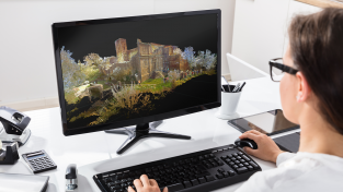
In today’s latest technology disruption, point clouds are forever in motion. Whether it’s capturing a crime scene, ensuring the most accurate BIM or preventing accidents in plants, laser scanning enables professionals to bring digital realities to life.
Welcome to HxGN Radio. This is your host Monica Miller Rodgers. Today’s podcast is brought to you by Leica Geosystems. Revolutionising the world of measurement and survey for nearly 200 years, Leica Geosystems creates complete reality capture solutions for professionals across the planet. Known for premium products and innovative solution development, professionals in a diverse mix of industries trust Leica Geosystems for all their geospatial needs. With precise and accurate instruments, sophisticated software and trusted services, Leica Geosystems delivers value everyday to those shaping the future of our world. In today’s episode we are talking about managing digital realities with Faheem Khan the vice president of business development for high-definition surveying at Leica Geosystems.
MR: Faheem thank you for being here with us today.
FK: Thank you Monica for having me.
MR: Let’s start off by telling our listeners what is high-definition surveying or 3D laser scanning and how does that relate to digital realities?
FK: Sure Monica. High-definition surveying technology is a technology that we introduced into the marketa decade ago. This is a proven technology. It’s a technology that uses a combination of high performance 3D sensing hardware with an accompanying software package that compliments this vast array of information that’s captured with these sensing products. So it’s really a tool that the geospatial professionals and other professions have turned to capture 3D environments at scale at high speed with simply a push of a button. So it’s quite an exciting technology and it’s been commonly deployed in the industry over the years. But just on the note of high-definition surveying we’ve been driving this technology for many years, and our customers the market the industry has also started to look beyond just the use of HDS technology but also other complimentary 3D data capture platforms, and Leica Geosystems is a proud innovator in this area. We’ve introduced technology such as mobile mapping systems, UAV mapping systems, a very unique multi-station technology that combines surveying and laser scanning technology. So we look beyond just HDS and in our software ecosystem we take advantage of all of this different 3D sensing platform to allow our customers to fuse the content and see the world in multiple perspective. So that in a nutshell, perhaps, is how would like to describe high-definition surveying technology for digital realities.
MR: And Faheem with that idea of going beyond just HDS and bringing in a lot of other solutions that certainly opens up opportunities. So maybe you could speak just a bit about these different applications where this cutting edge technology of laser scanning is being used.
FK: Sure Monica, and I think this perhaps is the most exciting part about 3D scanning technology, high-definition surveying technology is in the fact that we touch so many industries and deliver so much benefit across these industries. So perhaps let me walk through three industries that we spend a lot of time and invest a lot of our resources into improving the solution. I’d like to talk about the public safety profession, the construction industry, as well as the plant engineering requirements that we address. So maybe starting with the public safety solution area, we’ve been seeing an increasing number of public safety agencies turn to HDS technology to effectively and completely capture crime scenes and freeze them in time. The ability to walk into a crime scene, press a button and freeze this environment into a secure Point Cloud data base is something is something that our users take advantage of. This allows them to then carry out investigation, share the data with different stakeholders after the crime scene is cleared, and it also allows them to capture things that perhaps the naked eye doesn’t see in a very busy crime scene. While we capture vast amounts of 3D high-definition information our customers can turn to our software technology to produce the traditional 2D court specified deliverables that they need. So we introduced recently a software product called Leica Geosystems Incident Mapping Suite, a map 360, that software technology allows public safety professionalsto take advantage of 3D information coming from UAVs, coming from survey senses, coming from 3D laser scanning systems, backpack system, mobile mapping system to fuse that 3D environment and produce those traditional 2D deliverables that are still very much needed in addition to all the 3D information they can take advantage of. So that’s one example of an application area that we pride ourselves in providing complete full solution. If I turn to another application area this would be in the area of construction. The problems are completely different. In the construction industry our customers are using and turning to 3D technology to reduce rework. They want to make sure that what has been designed would fit at the right time, at the right schedule. That the cranes that have been scheduled and planned will not have to be disrupted because of certain design concepts were inadequate. So they prove a lot of these concepts in a digital environment without really testing out in field. Construction industry also turns to 3D technology to perform more accurate volume metric calculation to allow progress payment to be made in accordance to how much work was actually done. They also turn to the technology to very quickly check on progress. So we introduced recently a software capability, which we call Anti-Clash, which allows a design professional or a construction manager to incorporate a design model, import the scan data that’s been captured by our laser scanning system, run a simple query, and the software will find all of the elements that have not been built. Meaning it’s not been crashing. So it’s the reverse of a clash and that gives a good indication of what progress we’ve had what hasn’t been built. So things like this we will try to take advantage of the vast amount of 3D information that we capture very, very quickly but also trying to produce results more efficiently than before. The last example that I’d like to touch on is in the area of plant engineering. Here we have a diverse range of industry professionals looking at 3D technologies to extract different types of information, for instance, in an integrated solution that we provide with our sister company, Intergraph Smart Plant Fusion, we allow asset managers to very effectively fuse all of the unstructured content that they have a particular facility, particular asset with photo realistic 3D information. This gives all stakeholders the ability to find what they need on an engineering project, documents that might have been captured over decades but really very intuitively to extract this information through a very easy and familiar user experience which is the plant that they work on a day-to-day basis and carry out engineering activities accordingly. Last example, perhaps, around the plant engineering solution area I would like to touch on design. The fact that we can go onto offshore platforms, document all of these facilities and days and bring all that engineering information back into different design offices to allow them to design as according to actual as build saves tremendous amounts of money in terms of lost productivity and so on, and these are not concepts anymore. These are proven technologies deployed around the world over the past decade and at Leica Geosystems we try to make things more efficient for our customers and try to deliver more productivity ultimately.
MR: Well that’s certainly a diverse mix of applications where this technology can be used and you were able to point out some great benefits there to the users in each of these applications. So I see that being very beneficial, as you said, to the users and what Leica Geosystems is trying to achieve. Maybe you can give us an example of a project that has recently used the Leica Geosystems laser scanning technology.
FK: Sure, we were just talking about off shore engineering maybe I can just touch on this example. Just recently we were asked by one of our users who were working on a maintenance problem for an off shore rig to carry out design activities for retro fitting rig that was required for that platform because they wanted to increase the capacity. But what they wanted to do was to ensure that the fabricated components would fit the moment the ship offsite and this platform was located in a fairly hard to reach area. So they turned to HDS technology onsite where fabrication took place. They also sent a team offshore to that platform and they captured that facility and they did a virtual fit up analysis in the office to ensure that they won’t be surprises during the actual construction activity. And we’re very pleased to hear from the customer that that engineering project went on schedule, on budget, without any rework because everything fit it perfectly. That’s a typical example of how customers take advantage of this fairly easy to use 3D capturing platform to answer complex 3D questions.
MR: I certainly think that many of our listeners understand the importance of no rework and what that means to their businesses. So that’s quite impressive. Now Faheem you said earlier that the laser scanning technology of Leica Geosystems has been around for quite a number of years now, actually two decades, so what are the newest advances in HDS for Leica Geosystems?
FK: That’s an excellent question. So we’ve been pushing the boundary for many years. The first laser scanner would capture 800 points a second which was best in class at the time. The current technology captures a million points per second. So you can imagine we’re producing a lot more data a lot more quicker and our customers are also taking full advantage of all this productivity increase and their capturing a lot more information. So what we see is a classical big data problem. We see databases become bigger. We see data formats increasing and the complexity behind it increasing. So what we’ve done recently was to expand the support for these diverse sensing platform. We updated cyclone, our main Point Cloud processing software, to handle not only HDS data but also support mobile mapping data, support handheld mapping data, support imaging platforms, support data coming from UAV systems. So what our customer can take advantage of is a single piece of software, a single data base where they can fuse all of this content, but the content is huge and it’s becoming bigger. So what we’ve done from a technology perspective is to introduce a new database architecture, a new technology in essence, to allow our customers to further compress these Point Cloud databases without any loses, and to allow them to stream the data more efficiently into the final applications where they work in. And that technology is encompassed in Jetstream. We see compression ratios of around 50 percent. So a terabyte of database turns roughly 40-50 percent smaller. We see this terabyte of database being streamed over the network where you have been with even over the internet to different underlying applications, and that would be one area of improvement. We talked about the fact that we need to support these diverse sensing platforms, and one aspect of this is to allow our customers to register to merge these data sets. So this registration process is something that we’ve been trying to automate and improve over the past decade or so. I am quite proud to say I would that we have the best registration capabalility in the industry today. We allow our customers to use a first-aid kit, if you’d like, to solve all registration problems using cyclone register. So recently we introduced more automation into our registration workflow using more assisted techniques allowing our customers to have more productivity in this area. So now you have databases that are registered, you have databases that are efficient, compressed, that give you all the data all the time. To further take advantage of this information we also want to reach out to those customers who don’t need the full range of 3D information. Maybe all they want to do is to open their iPad, their iPhone, their browser to look at this high-definition as built 3D digital reality, and to support that capability we released a software product called Truly Global. Just recently, some weeks ago, we’ve updated that platform to allow our customers to have a more secure experience around the content and the projects that they share to allow them to collaborate effectively, but only in the projects that they work in. Not only this we allow them to generate this photo realistic web-based deliverable using not just traditional tripod based laser scanning systems but any 3D information. So now you can create Truviews, which are tool sets that our customers are very familiar with, but you can create these Truviews from any location and from any data source. This could be from mobile mapping data, could be from UAV and could be at any location. So these improvements, these advances hopefully allow our customers to be more productive and to reach to more stakeholders who need this 3D information.
MR: Faheem in the last 20 years Leica Geosystems has certainly made quite a few advances in laser scanning technology, and I am sure they’re not done innovating yet. So can you give us an idea of what’s on the horizon or any sneak peeks of new technology that’s coming?
FK: Sure, I’m pleased to say yes we are very busy working on many new projects, and I’m please to say that we’re driving the innovation in a couple of important areas. Areas that our customers tell us are important to them, for instance in areas of automation. We want to further automate these end-to-end processes from data capture all the way to deliverable production. We want to make our solutions more localized. So if a Japanese police offer needs to work in the environment and the familiarity that he expects from our solution versus a Brazilian officer, versus an American police officer for instance. We also introduce more intuitive QA processes in the entire workflow. At Leica we do definitely pride ourselves in the quality that we deliver in our solutions, and we want our customers to be able to equally deliver quality deliverable. How they validate this information is important to us, and it’s important to them. So these are some of the areas but we have many more projects under our belt and we look forward to seeing more improvements, more productivity, more efficiency over the next years to come.
MR: Certainly an exciting future ahead for this technology. Faheem thank you so much for being here today, and being our guest on HxGN Radio.
For our listeners you can learn more about high-definition surveying at leica-geosystems.com. Tune into more episode from HxGN Radio on iTunes, SoundCloud or Stiticher Radio. Thanks for listening.


![[PODCAST]: Digital Realities Management](https://blog.hexagon.com/wp-content/uploads/2016/07/artworks-000171280748-001m1c-t500x500-500x391.jpg)


