BK: Welcome to HxGN Radio. My name is Brian. Thanks for joining us today. We have Jeff Gerber from Clark Builders and Matt Wheelis from Leica Geosystems to discuss how you can prepare and execute construction tasks faster, simpler, and more accurately. Thanks for joining us guys.
JG: Glad to be here.
BK: Measure, layout, and 3-D capture happen in between the construction and the completion of a building. Digitalisation makes you more efficient and provides more business opportunities. Leica Geosystems ensures that the essential phase with the most reliable data and an easy-to-use solution, to ensure the finished building is on time and on budget. So, Jeff, as an avid iCON user, how do iCON solutions provide added value to your layout projects?
JG: At Clark Builders, we have six surveyors in our fleet, and we cover various jobs, sometimes multiples up to 12 at any point in time. Having the ability to copy the project data fully and then just email it to somebody else loaded across a thumb drive and away they go, knowing that they have the carbon copy of what we’ve already set up is very great. Then you know that everything lines up and all the controls and everything looks the way it should be. Also having the ability to create a 3D surface for a layout is very good. I’ve used it for parking lots or sloped concrete, doing that terrain stuff.
BK: Okay. Excellent. Matt can you explain a little bit about how Leica Geosystems new iCON layout solution is digitalising workflows, helping users to prepare and execute construction tasks faster, simpler, etc. I’d love to hear about this.
MW: So, that’s been really the vision behind iCON from the start. However, complex the design, however complex the form that designers come up with, our job with iCON is to make that as easy as possible for people to layout, to really connect to the ground, and to get that in the right spot.
The way we do that is by rather than thinking about a survey task, we’re thinking about a construction task and what needs to be accomplished out there in the field. With iCON, one of the key differentiators and one of the key aspects is the ability to take a model, like a building information model or a 3D model, through a file format called IFC or Industry Foundation Classes and directly out to the people in the field.
That’s the kind of thing Jeff is talking about, how he just takes it right there on the thumb drive. Out in the field, the people have a fully rendered model that they can work from in the field. No matter how complex the form, we simplify it, because honestly, we don’t care whether it’s a straight line or a spiral tangent. We can lay that out in the field.
With the new solution that’s come out, the newest version of iCON software version 4.0, we have a solution we call auto staking. This enables us to essentially point the red dot directly where we should put a nail or a stake or something like that, making it very simple for the person in the field.
When you have multiple crews and multiple people working on a site, we have the ability to have multiple stake lists or those points that each of the crews can work with simultaneously. We really simplify the workflow out of the field with those IFC files, such that we can give you exactly the points that the people are looking for in the field.
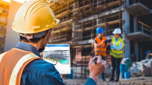
Additionally, one other thing I think is a neat new innovation with iCON 4.0 is the ability to take that tablet that you’re using to control that robot or robotic total station and take photos and attach that as evidence of the fact that we’ve done that correctly or have evidence that there might be a problem in the field.
BK: What’s new and improved with the iCON layout robots?
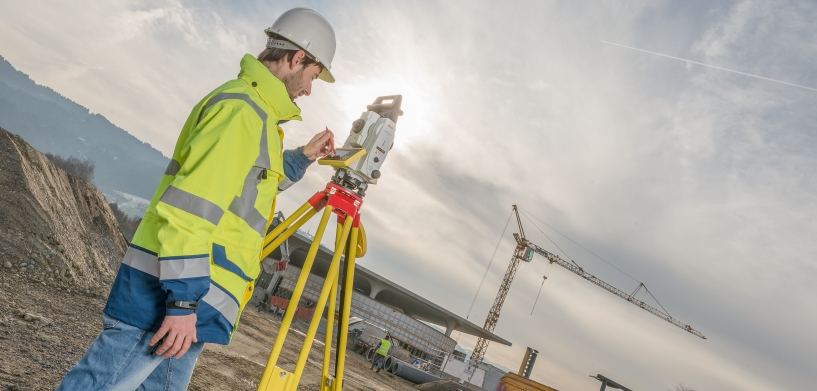
MW: For the robots themselves, and that’s the hardware, they are robotic total stations, which means they have a motor in them and they are a one-person operation. The big new innovation here or the new aspect here with the iCON versus the previous generations is what we call ATRplus.
It’s an ability for the total station to stay locked onto that prism, no matter how or where you move it. It’s got an auto-learning capability in it where it recognises the signature of that prism as being different from any other shiny object. So, if there’s multiple crews working on site and two prisms pass each other, it’ll keep up with the correct prism, or if there is a shiny mirror or something else that might distract another total station, this one stays locked onto that prism.
BK: Excellent. Jeff you’ve tested the latest Leica iCON build field software. How does it differ from other construction field software packages? How do you see it simplifying your workflows?
JG: The biggest difference is how simple it is. You don’t need a third-party software to manage the points. It just creates them automatically from the DXF or the IFC files.
BK: Nice.
JG: Just load it up and go. It works ̶ 3D instantly.
BK: Okay.
JG: With simplifying workflows, we don’t need to manage the points. That’s the biggest thing.
MW: The crews working in the field are accustomed to either looking at a blueprint representation and working from that or looking at perhaps even a model. They often are not accustomed to thinking about the points themselves. So, with iCON, it seems we’re able to take that complexity out for the end user where they can really think about the project in a way that they’re accustomed to, with other sources of information.
JG: Yes, very correct.
BK: I’m assuming it’s also helped to not only simplify processes, but what your efficiency levels look like. Have they gone up significantly?
JG: Yes, very good. 25 to 40 percent.
BK: Wow, okay. So, it’s allowing you to do things you know that you need to be doing, more importantly, rather than spending time on other things.
JG: Point layout, as an example, we’ve gone from our previous stuff doing about 30 points an hour to where I can easily double that.
BK: Okay. Is this one of the reasons why you invest in iCON layout robots or what are the other reasons on that?
JG: Initially, there was a parcade project that we were working on, and there were some interesting slopes and ground structures to be installed. Having the surface abilities for layout with the iCON and utilizing Revit files IFCs from our BIM department made things very easy and slick.
BK: What’s been the overall response, companywide?
JG: Very good support. Mind blowing.
BK: Good. Good to hear. Matt how is the overall solution shaping the future of the building construction industry?
MW: One of the things that I think is a trend and will continue to accelerate is that of everything being connected together. The building construction industry is complex commercially. There are many different subcontractors on a given project. There is dirt to be moved at the beginning, which involves data on machine control. There are things that are underground that are utilities that need to be detected. Then, of course, there is all the wonderful work of building the building, and then capturing that information and comparing it to what was supposed to be.
What we’re driving and where the industry’s going is around connecting all that together in a way that is very transparent to the end user. The information is simply available, and the solutions simply work. They don’t have to think about file translations and other complex things that, frankly, they don’t have enough time to do spend on. They need to go build.
BK: Exactly. Well, it’s always great to see what you’re doing. It’s also wonderful to see how it’s actually impacting someone that’s using it. So, thank you both for being here and sharing your information on this. Thanks for actually designing this and making this happen and thanks for using it and seeing success. More information on this, by the way, you can go to Leica-geosystems.com. Matt and Jeff, thank you very much, appreciate your time.
MW: Thank you.
JG: Thank you.
BK: HxGNSPOTLIGHT.com is the place to go for more episodes and to learn more information. Have a great day. Thanks for listening.


