


Growing up on the coast, Wells Howe has always felt an affinity for the ocean. “I can remember the first time I saw a whale — I just felt so alive,” he said. “Most of my formative childhood memories — certainly the ones that made me want to protect nature for my grandkids and future generations — came when I was interacting in the water.”
Today, Howe is working towards his goal of protecting our oceans as the Blue Carbon Program Manager for Beneath The Waves. Founded in 2013, Beneath The Waves is a non-profit ocean research institute that uses cutting-edge science to drive ocean policy. The organisation has published over 100 scientific papers and reports, made numerous first-ever discoveries and protected approximately one million square kilometres of ocean throughout the Caribbean and Atlantic.
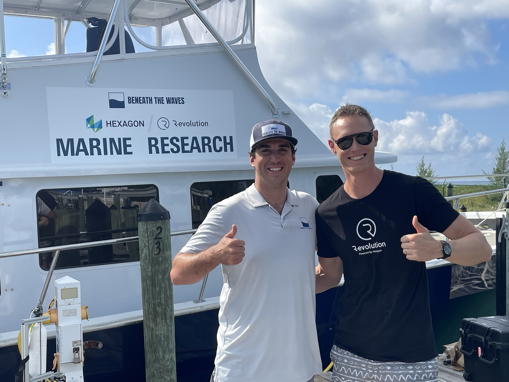
Wells Howe, Blue Carbon Program Manager, Beneath The Waves and Erik Josefsson, President, R-evolution
Howe wears many hats at Beneath The Waves but is ultimately in charge of spearheading the organisation’s partnerships, science and conservation strategy around climate change as it relates to the ocean. This means focusing on key habitats, species and healthy ecosystems that fight against emissions and carbon.
“We’re a group both of established and emerging leaders in marine conservation, focusing primarily on threatened species, with a deep affinity for sharks,” said Howe. “You can even see us during Shark Week on the Discovery Channel.”
This affection for sharks — tiger sharks, to be precise — is what led Beneath The Waves to one of their largest discoveries to date: a massive seagrass meadow off the coast of the Bahamas.
“Aside from being really cool, tiger sharks are apex predators. They’re almost like the great white shark of colder waters, and so they’re really stewards of healthy marine ecosystems,” Howe said. “Quite honestly, they’ve been the perfect collaborators for our blue carbon initiatives because they’re migratory animals, so they connect a multitude of ecosystems and locations.”
To take advantage of the vast distance these tiger sharks cover, Beneath The Waves deployed a number of satellite tags to track their movement, equipping the animals to work as de facto oceanographers.
“They’re really travelling to places and providing us with scientific data and clues that we as humans can only dream about,” he said. “They’re far more efficient.”
To date, Beneath The Waves has tagged hundreds of tiger sharks; however, one is particularly near and dear to the team: Mabel. Through watching Mabel and other large (four-metre plus) sharks, the organisation found something that surprised them — in areas that had been previously undocumented and underexplored, they found dense patches of seagrass meadow in the middle of these marine banks that were four or five meters deep.
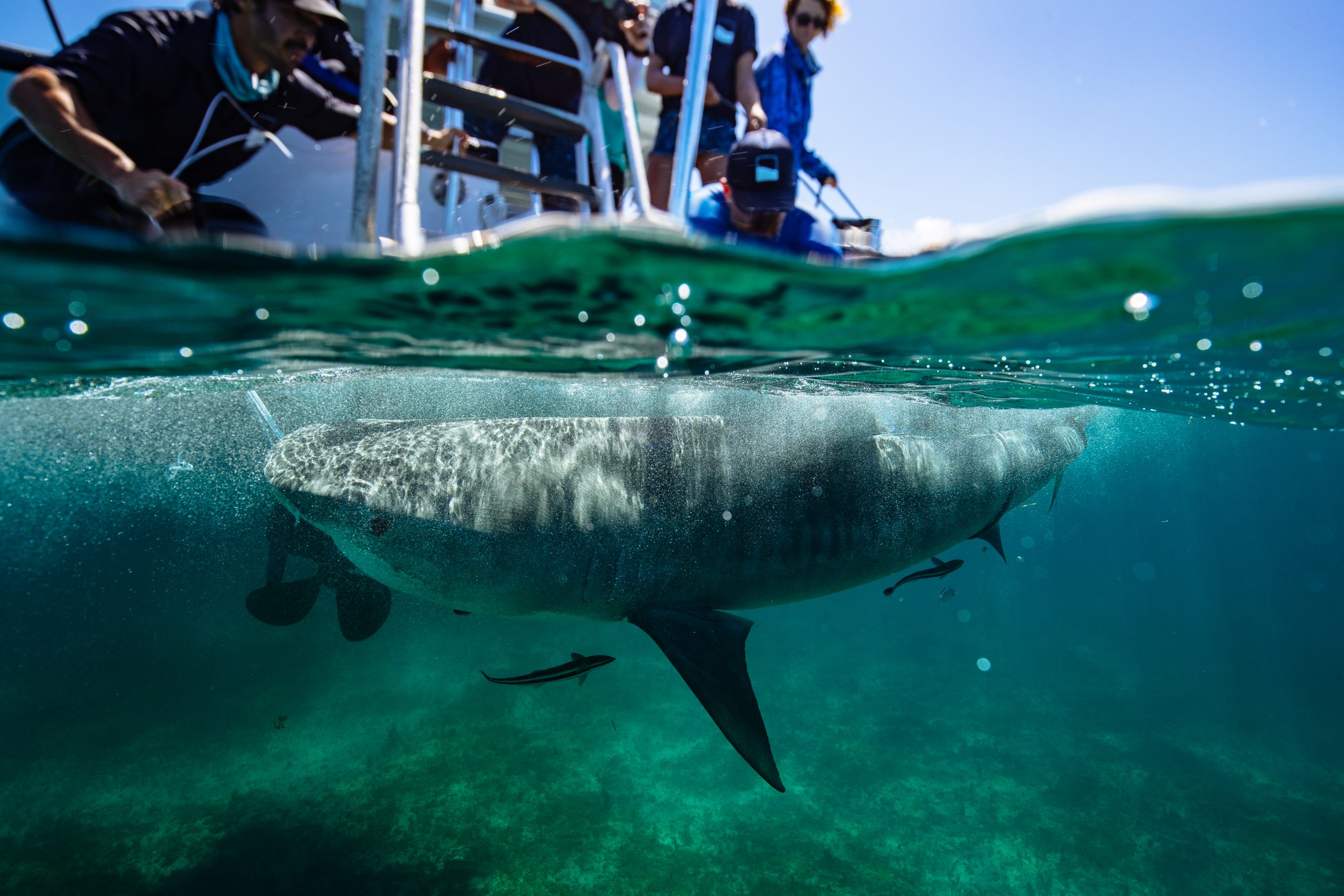
Mabel
This discovery has a number of exciting implications for science. Because seagrasses are flowering plants that grow through photosynthesis, they pull CO2 from their environment and provide oxygen back to the ocean. But what makes seagrass meadows truly unique is that — unlike their land-based counterparts (rainforests) — this carbon is stored and locked away in marine sediment for hundreds of thousands of years.
“If you looked at one acre of seagrass and compared it to one acre of rainforest, that seagrass is going to trap four to five times as much carbon,” Howe said. “It’s one of the best nature-based solutions that we’ve ever found and presents one of the biggest opportunities to fight climate change.”
The Bahamas provides the ideal environment for this seagrass meadow to thrive because it comprises two shallow carbonate banks; in fact, they are the largest shallow-water carbonate banks on the planet. This allows light to penetrate through the water so the seagrass can grow.
“They’re so large you can actually see them from space. Many of the astronauts who have been onboard the International Space Station say the most beautiful part of their orbit around Earth is when they get to the Bahamas because the water is so bright blue and transparent,” Howe said. “It only fits that the largest seagrass meadow, and some of the healthiest seagrass meadows on Earth, are found there.”
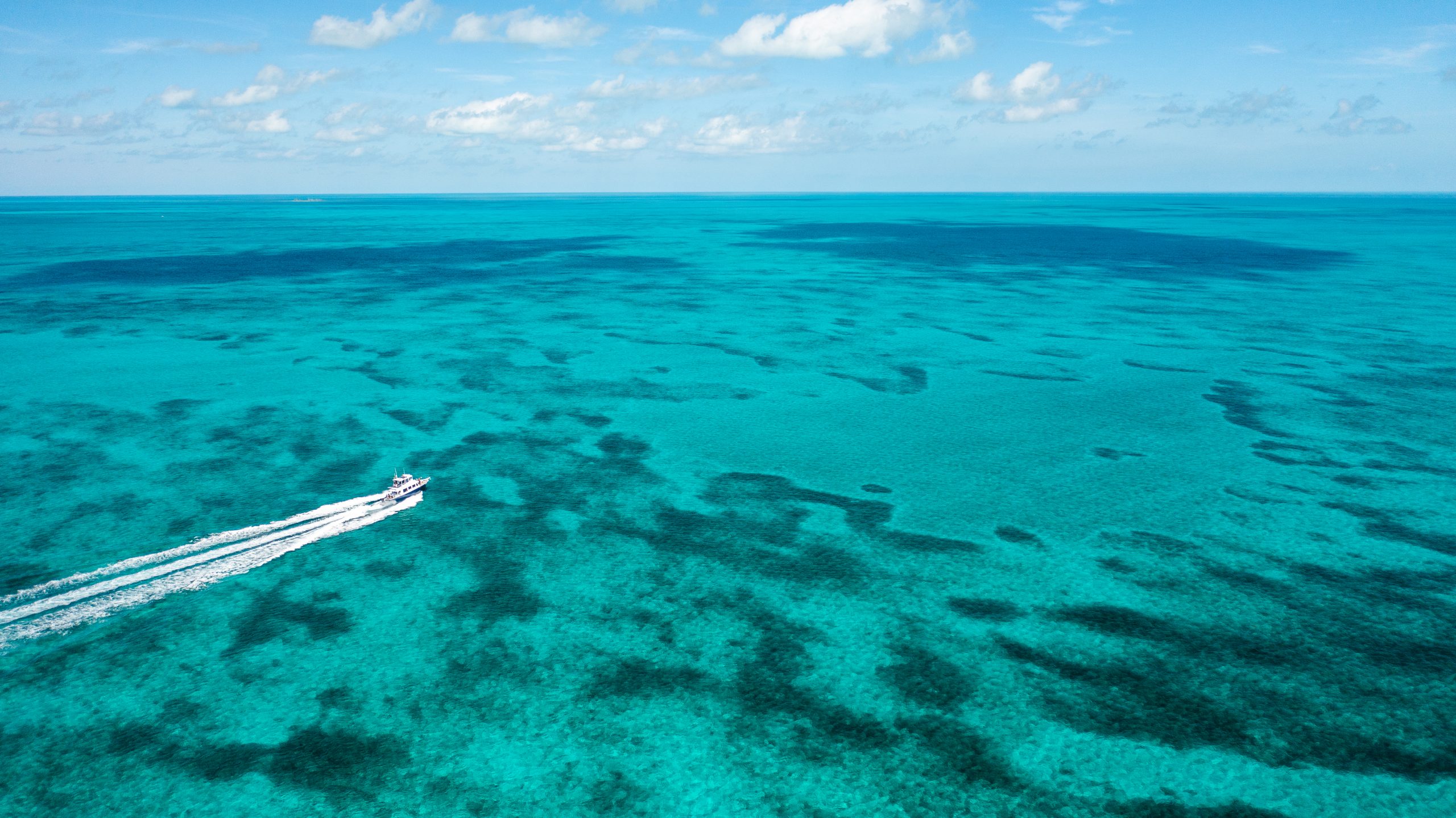
Due to the impact this seagrass meadow has on the health of the ocean — and the planet overall — Beneath The Waves launched an initiative to conserve it. The first part of protecting this vital environment was actively mapping it, which led Beneath The Waves to partner with R-evolution, powered by Hexagon. Together, the organisations used aerial light detection and ranging (LiDAR) scanning technology to measure the seagrass meadows and to establish benchmarks for future comparison.
“In the past, we had been reliant on remote satellite imagery or passive mapping techniques that were not accurate enough. They were out of date and didn’t give us a fine enough resolution to see where seagrass meadows may exist,” Howe said. “Nor was it repeatable, so we couldn’t see the health of seagrass overtime. Partnering with R-evolution to use LiDAR scanning has allowed us to promote the health of our planet by deploying a solution that’s been previously untested, and so we now have that fine-enough resolution to track the health of the ecosystem and really create a year-over-year recurring opportunity for the Bahamas and other island nations.”
The R-evolution team had their own opportunity to understand the impact that their 3D mapping would have for ocean conservation. The day before they started flying, groups from R-evolution and Beneath The Waves went out to visit the pilot location for mapping — a place called Tiger Beach due to the large number of tiger sharks who use it as a visiting ground.
“You could see the excitement of the Hexagon folks when they saw all of these sharks behind the back of our research vessel and could directly see why protecting seagrass mattered for the health of this vibrant ecosystem,” Howe said.
During the expedition, Howe worked from the research vessel by taking sediment core and documenting the health of the seagrass meadows. “I remember seeing the plane fly overhead and knowing that — in real time — there were thousands of photons being shot through the water column using algorithms to classify the habitat I was seeing with my very eyes,” he said. “It was like a dream realised.”
The potential outcome of this project is providing protections for large areas of the ocean and biodiversity hotspots for generations to come. It will also present significant financial and leadership opportunities for the Bahamas as well. Hundreds of Bahamians will be employed in conservation-related roles, which could generate significant revenues. Mapping and valuing the seagrass accordingly will also allow Bahamians to protect the blue natural capital wealth they have and to be recognised for these efforts on the international stage.

Beneath The Waves’ 3D mapping expeditions are also the first part of the process for generating carbon credits for the Commonwealth of the Bahamas. In addition to mapping the seagrass meadows with R-evolution, Beneath The Waves also collected sediment cores to measure the exact amount of carbon that is sequestered and stored in the marine sediment. By overlaying these two maps, scientists will get a holistic view of the total amount of carbon that’s taken out of the atmosphere and stored.
“With that output, we’ll be able to track the health of that ecosystem year over year,” said Howe. “And — through the implementation of these new marine protected areas — these ecosystems will be safeguarded from degradation since there will no longer be dredging and carbonate mining or oil and gas discoveries.”
This protection will allow the carbon to stay locked and sequestered over time and will be evaluated by an independent international third party that will quantify the carbon in terms of CO2. If the Bahamas can keep that carbon sequestered from the atmosphere, they will be issued carbon credits in the form of one credit for every ton of CO2 that’s kept trapped underground.
“When you hear private corporations — even public nations — talking about meeting net-zero goals, oftentimes they’re using carbon credits,” Howe said. “This initiative from The Bahamas is the first to ever undertake getting carbon credits with seagrass.”
Beneath The Waves will continue its conservation efforts by expanding its 3D mapping across the banks of the Bahamas to see where seagrass ecosystems are thriving and where they are struggling so progress can be tracked year over year.
Howe sees a future where corporations can work together with non-profit organisations to make an impact for our oceans. “To truly turn the tide on ocean conservation, we need to think outside the box. The Bahamas is seeking out recurring revenue streams that protect and value our ocean,” he said. “It’s an exciting time for us in the ocean conservation space to see new models being tested.”
Thanks to Beneath The Waves, R-evolution’s LiDAR scanning, many scientists — and a tiger shark named Mabel— a positive impact for ocean conservation is being made in the Caribbean today.
[Related content: Hexagon’s R-evolution expands its sustainability agenda to help protect coastal blue carbon ecosystems]


