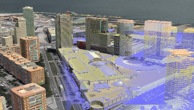
Olsson Associates has developed new relationships and breathed new life into its Land Survey practice by adding Leica Geosystems 3D Scanning and Aerial Photogrammetry technology into its solutions portfolio.
BK: Welcome to HxGN RADIO. My name is Brian; thanks for joining us.
We are going to be exploring how Olsson Associates has developed new relationships and breathed new life into its land survey practice by adding Leica Geosystems’ 3D scanning and aerial photogrammetry technology into its solutions portfolio. Joining me today is Eddie Fossler, survey technical leader at Olsson Associates, and in today’s episode, we’re going to be discussing 3D scanning and aerial photogrammetry. Eddie, thanks for joining me.
EF: Thank you, Brian. This is a great opportunity. I appreciate it; thank you.
BK: Yeah, appreciate this. Tell us, first of all, a little bit about Olsson Associates.
EF: Yeah, so Olsson Associates is a firm, a civil engineering and survey firm, that’s based out of Lincoln, Nebraska. It was started in 1956. Currently, we have offices in seven states in the continental U.S. and a little over 1,000 employees right now. So most of our focus, we kind of run the gamut on civil-survey type applications; we do environmental, structural, stuff like that, transportation, engineering. But right now, really what my job is, is to really build out and keep continuing to grow our 3D capabilities in our survey practice.
BK: Excellent, excellent. So when is aerial land survey usually even needed?
EF: So typically, we decide to do something like this when it’s a large-scale-type project, either just by sheer land mass or even just length. So it could be real super narrow, but just really long miles. Right now we’ve done it mostly in the realm of railroad- and transportation-style projects, and we have done a handful of kind of large acreage and quite a large stockpile area to quantify those areas. But yeah, right now it’s transportation and railroad are some of the bigger focuses on some of our UAV applications.
BK: Okay, so, are those the main business sectors that usually require these kind of things, or are there additional ones that are in for that?
EF: Yeah, right now we’re really trying to find areas for the UAV that work best. The thing with us, specifically with the photogrammetry, which is right now where we’re at with how we acquire data with the UAV, using photos to then create a point cloud at that point and then extract data from that point cloud. So with that, with photogrammetry, there’s a little bit of a difference in accuracies than what you would get with, say, a LiDAR solution. So once you have that difference in accuracies, where there’s a little bit more fluff in a photogrammetric point cloud, so with that, some of the applications you go after are, the tolerances are a lot bigger, and that’s okay depending on the scope of the project.
So right now we’re a little bit exploring into the LiDAR end of things, which would bring those accuracies a lot tighter and allow us to go after some more design heavy. A lot of this stuff is very kind of like conceptual-project stuff, except when in regards to the transportation and the railroad. Those tolerances aren’t nearly, at least for the scope that we’re looking at, we’re okay with the photogrammetry tolerances, so that’s why we’re sticking with that technology on that sense.
BK: Okay, excellent. Now, where do you see it going in the future?
EF: Right now, what I see happening with it, if we can acquire—and we will be acquiring LiDAR at some point fairly soon—but with that, that’s going to really start marrying the UAV and the ground-based scanning. We did try to do both with the photogrammetric and the ground based, and because of that difference in density of the point clouds, it’s two different worlds you’re trying to get to work together. So once we start doing LiDAR scanning, you still may have a variance in the density of your point clouds, but what’s going to happen is you can start unifying them a little bit more with the ground base. So I can see those two technologies working in conjunction with each other a little bit more down the line.
BK: Okay, excellent. So what are some of the advantages of 3D scanning in land service, for example?
EF: So 3D scanning for us, when we first got into it, one of the things for us was just wrapping our head around this new technology and how we’re going to do that. Thankfully, it’s been almost five years now of us going after 3D scanning and using it. So we’ve gotten past that initial, how do we use this? Now we’re trying it on, basically, anything we can. What we’ve noticed is, we’ve increased, essentially, our value because what we’re working for clients, and even internal clients, teams that we would never have worked with before as a land survey company, specifically like the mechanical and the structural teams, acquiring data for the inside of abandoned buildings, or an infrastructure project that’s being added to a building or something like that. Where as surveyors, you may be—we’re onsite to give them a singular hard measurement. Now we’re acquiring the entire building and then handing that point cloud, that data, off to the design team. It’s creating relationships and adding value to us at that point.
BK: That’s great. You’ve got to have that.
EF: Oh, it’s exciting.
BK: Yeah, nice.
EF: It’s fun; you learn things. This classic line of, “You don’t know what you don’t know.” You know?
BK: Yeah.
EF: And so when you sit down and have these conversations, you start … it kind of breathes new life not only into your business but, frankly, your career, too, because it becomes exciting again.
BK: That’s a plus.
EF: So it’s been very, very fun.
BK: That’s important.
EF: Yeah.
BK: Not to mention, too, if you think you know it all, then you’re … that’s a bad thing, too.
EF: Exactly.
BK: So it’s always that constant curiosity of learning—
EF: Oh, yeah.
BK: —and just like you said, that excitement, too. So that’s fantastic.
EF: We have a 30-year-guy, career people, who have been reinvigorated. It’s just fun to watch.
BK: Nice, nice.
EF: So it’s a very cool technology, and we’re just excited to keep finding new ways to use it.
BK: Great! So does the aerial photography help the speed from this standpoint?
EF: Yeah, so with UAV, whether you’re using photogrammetry or you’re using LiDAR, you cover a large area in a short amount of time. Our UAV pilot’s going to murder me here if I get this wrong, but I believe he said he flew 40 acres in less than 10 minutes.
BK: Wow, okay.
EF: And 40 acres … and once again, with photogrammetry, you’re dealing with a little bit of a tolerance variance that you have to be okay with, but we can get that down pretty good as far as photogrammetry is concerned. But a lot of those giant-acreage-type surveys tend to be conceptual in nature anyway. So he’s flown 40-plus-acre sites in 10 minutes. That, you’re requiring a lot of data very quickly.
BK: Excellent. So how has it altered aerial photography; that is, how has it altered the way we perceive environmental change?
EF: One of the ways that we’ve been seeing it specifically has been, at least where—we’re in Nebraska. At least, the office that I’m in is based in Nebraska—and what I’ve seen in projects has been erosion, specifically with rivers and river monitoring.
BK: Yeah, yeah.
EF: You’re able to use this technology to monitor erosion and see actual sheering of sides of the banks of these rivers being kind of inundated and compromised a little bit. So yeah, this has kind of allowed and empowered, I think, us and other firms to be able to use it for environmental monitoring.
BK: Good, good; excellent.
EF: Yeah.
BK: So how do you think the 3D scanning and aerial photogrammetry will change our perceptions in the way that we work?
EF: Well, I think, once again, before … for surveying, it was very much, go out and get this measurement, or a handful of measurements. And in this regard, whether it’s ground based or the UAV, we’re acquiring a lot of data in a very short amount of time.
BK: Yeah, yeah.
EF: And so with that amount of data, and with the accuracies you’re dealing with, what happens is the conversation just naturally changes. So instead of, oh, we forgot to get this part, or the design creep takes you out of what they thought was the original design area and now you enter into a pocket with these types of data collection methods, we can acquire way more data, way more quickly, and have that conversation on the table and not have to go back out in the field and reacquire it again. So it’s gotten more efficient, frankly speaking.
BK: Good, good; excellent. Well, it’s a good thing, and it’s going well it sounds like. So, what’s the future looking like, and last pieces of—I would say advice, but I’m not sure that’s the right word—but even just comments and thoughts that you have.
EF: The future, honestly, if I had to look at it, as far as we’re concerned, I think right now, we got over the growing pains, and now we’re having more sophisticated conversations with … like at Hexagon, here, with fellow users of the technology.
BK: Yeah.
EF: And so at that point—talk about changing the conversation—now it’s about, how do we build on what we’ve already created—
BK: Yeah.
EF: —but also start getting a little bit more intelligent about our workflows and about how we process and then hand off that data to clients. So client education, I think is going to become more and more of a sophisticated thing.
BK: Mm-hmm.
EF: And also, frankly—and I like this; this is just kind of how I’m wired—informational sharing with different users of the technology so that over time these things become more robust and more efficient.
BK: Sure, yeah, and making sure that everybody has that coordinated, I guess is the right phrase on that.
EF: Yeah, by the nature of what we’re all doing, on some level we’re all competing on some level. But on the same token, being able to meet at a neutral spot and have these kinds of discussions is really empowering. At this point, as the technology gets better, frankly speaking, we’re equipped with the mindset to be able to kind of adapt with it.
One of my team members said, “It’s easier to play …”, what was it, “catch up”? I’m going to butcher this; I’m butchering it as we speak. The long and short of it is, I’m glad that we’ve done the hard work now and now, at this point, we’re just going to keep building up what we’ve already created and learned.
BK: Yeah, excellent. Eddie, this is awesome. Thank you for sharing all of this. Very exciting times, and good to hear, and I’m glad that you and the team are just excited and still on board with this kind of stuff, learning new things and doing a lot and helping a lot of people. So thank you for sharing all of this. Thanks for your time here today.
EF: Thank you so much; I appreciate it.
BK: Now, you can learn more, by the way, about Leica Geosystems’ 3D scanning and aerial photogrammetry technology at leica-geosystems.com. Check it out. And be sure to tune in to more episodes on HxGNRADIO.com, or you can go to iTunes, SoundCloud, or Stitcher Radio. Thanks for listening.


